


Listed at more than 50 acres
By Jon Johnson
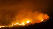
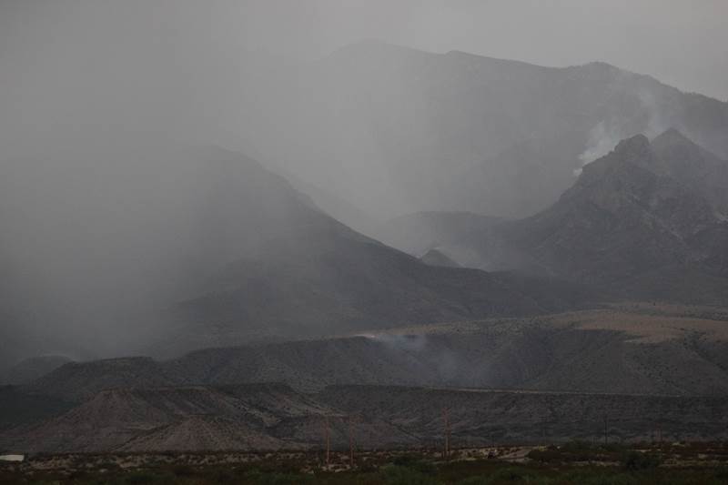
MOUNT GRAHAM – The lightning-caused Frye Fire has more than doubled it size from its Friday estimate to more than 50 acres as of early Saturday afternoon. The size increase is unmistakable from photographic evidence gathered by Gila Valley Central.
The fire is projected to grow at a moderate rate and move toward the Frye Mesa Reservoir. While the Mount Graham International Observatory can be seen in some photos by Gila Valley Central, the observatory is not at risk at this point, according to fire officials.
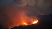
Jon Johnson Photo/Gila Valley Central: The Mount Graham International Observatory can be seen along with the Frye Fire but Forest Service representatives say there is current little danger to the observatory.
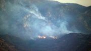
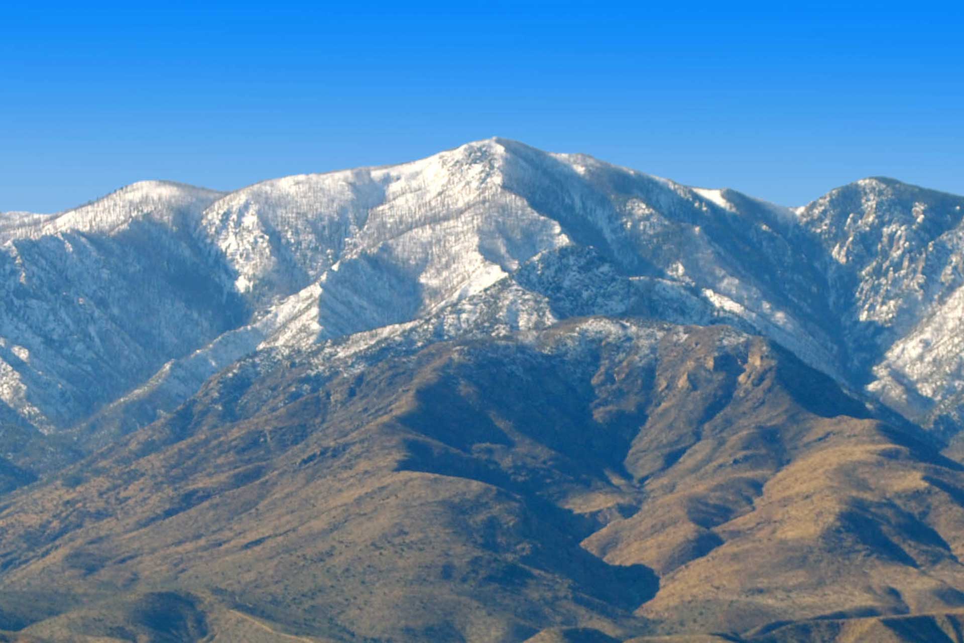
The fire is burning in the scar of the Nuttall Complex Fire from 2004, which was a combination of two lightning-caused fires, the Gibson and Nuttall fires, that came together to burn roughly 30,000 acres in the Pinaleno Mountains. Currently, fire personnel are taking an indirect strategy to confine and contain the fire within the Nuttall Complex Fire burn scar. Coronado National Forest Service Public Affairs Officer Heidi Schewel previously told Gila Valley Central that the strategy is also due to the inaccessibility of the area and for firefighter safety.
“It’s in real rough terrain, (and) it is unsafe to put people in there,” Schewel said. So, we’re going to be looking at where we can use control features to burn it to.”
The burn scar has numerous downed logs and snags. Fire personnel will continue to monitor its behavior and assess the values and risk to limit high-severity effects to forest resources. Current estimated containment is listed as July 30.
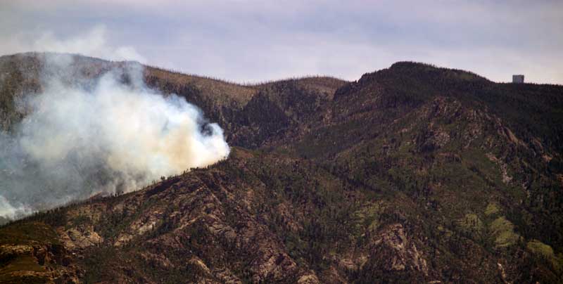
Eric Burk Photo/Gila Valley Central: Thunderstorms lit at least two fires on Mount Graham on Wednesday afternoon. One thunder cell ignited the Frye Fire (top right), in a canyon above Frye Mesa, while a storm later that afternoon ignited and then extinguished a fire (bottom center) on the eastern rim of Frye Mesa.
The fire was started by lightning Wednesday at about 2:45 p.m. Another storm blew through afterward and started another fire, which was then put out by rain from the same storm.
A community meeting is planned for Monday, June 12 at 7 p.m. at the Graham County General Services Building to inform the public about the fire.
Stage I Fire Restrictions remain in effect for all of the Coronado Forest and several hiking trails on Mount Graham remain closed.
CLOSURES: The restricted area involves the following area boundary of the Pinaleño Mountain Range: East forest boundary on 366 to Noon Creek to a point north and east of Shannon Camp Ground continuing northwest to Forest Road (FR) 507 on to FR669. Continue northwest and exclude Mt. Graham International Observatory, Old Columbine and Bible Camp. Continue southwest to FR 803 at Soldier Creek Camp Ground then west-northwest to FR 88 to Webb Peak- Straight north to Forest Boundary- Proceed east, then southeast along Forest Boundary.
The following trails will be closed: Ash Ridge Trail # 327, Ash Creek Trail #307, Ash Creek Detour Trail #307A, Frye Canyon Trail #36, Fry Canyon Detour Trail #36A, Round the Mountain Trail #302, Deadman Trail #70, Gibson Canyon Trail #308, Webb Peak Trail #345, Shingle Mill Trail #35, Rincon Spring Trail #331, and Trail #4527 off FR 508. No roads or campgrounds in the Pinaleño Mountains are closed at this time.
Temporary flight restrictions will be in effect over the fire area, and remains in place until further notice. This restriction includes “drones” or unmanned aerial vehicles. The public is reminded that “If you fly, we can’t!” Aerial fire suppression resources will be grounded if drones enter the restricted airspace, which could result in serious consequences.
Schewel said it is imperative to be fire-aware at this time of year.
“The Frye Fire is one of the examples of conditions that are out there on the ground,” she said. “There is a lot of fuel available across the forest at different elevations and all it takes is one spark to start a wildfire.”
Stage I Fire Restrictions
Beginning May 24, 2017, and until rescinded, the following are prohibited:
• Building, maintaining, attending, or using a fire, campfire, charcoal, coal, or wood stove fire, except within a developed recreation site, or improved site.
• Smoking, except within an enclosed vehicle or building, a developed recreation site, or while stopped in an area at least three feet in diameter, that is barren or cleared of all flammable materials. (Smoking is prohibited in federal buildings including rest rooms.)
• Discharging a firearm, air rifle, or gas gun, except while engaged in a lawful hunt pursuant to state, federal, or tribal laws and regulations.
• Welding or operating acetylene or other torch with open flame (prohibited on Coronado National Forest).