

By Jon Johnson and Eric Burk
MOUNT GRAHAM – A lightning-caused fire on Mount Graham in the Pinaleno Mountain Range is being monitored with an indirect strategy as of Thursday due to the rough terrain, heavy fuel loading and high number of snags in the area.
A thunderstorm that came through the area actually started two fires on Mount Graham, but the smaller blaze was extinguished by the rain.
New Mexico resident Robert Cordova was building a driving range tee at the Mt. Graham Municipal Golf Course when the lightning forced him to head inside for safety. He then drove his car to a spot outside Quail Ridge and watched the storm. He witnessed both lightning strikes that started the fires.
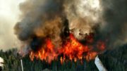
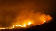
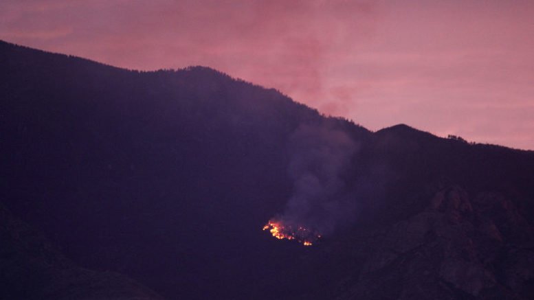
Eric Burk Photo/Gila Valley Central: Thunderstorms lit at least two fires on Mount Graham on Wednesday afternoon. One thunder cell ignited the Frye Fire (top right) in a canyon above Frye Mesa, while a storm later that afternoon ignited and then extinguished a fire (bottom center) on the eastern rim of Frye Mesa.
The larger blaze was ignited at about 2:45 p.m. and has been dubbed the Frye Fire. It rests in a burn scar of the 2004 Nuttal-Complex Fire above Frye Mesa Reservoir and is burning timber, brush and heavy, downed wood from the previous fire, according to Coronado National Forest Public Affairs Officer Heidi Schewel.
“It’s in real rough terrain, (and) it is unsafe to put people in there,” Schewel said. So, we’re going to be looking at where we can use control features to burn it to.”
As of late Thursday afternoon, the fire has burned approximately 10 to 15 acres. Based on current conditions and fire behavior, it is expected to shift northeast toward the Frye Mesa Reservoir area, according to Schewel. A Type III incident management team has been ordered for the blaze and currently there are three engines, two helicopters and other miscellaneous resources assigned to the fire.
Other fires in the Coronado National Forest include the lightning-caused Lizard Fire two miles southeast of Dragoon, which has grown to about 3,500 acres with 0 percent containment and the Paige Creek Fire in Paige Creek on the east side of the Rincon Mountains. That fire is about 200 acres and the cause is under investigation. All of the Coronado National Forest is under Stage 1 Fire Restrictions (see below) and there is also a temporary flight ban, including drones, over the fire affected areas.
An additional fire was also reported on the Eureka Springs Ranch in Aravaipa.
National Weather Service Tucson lead forecaster Jim Meyer said the storm looked normal on radar and that even normal storms can have frequent lighting. He said the cell covered Mount Graham and began at about 2:15 p.m. on Wednesday and ended around 2:55 p.m.
“It looks like it started just southwest of Mount Graham, near Bonita or Fort Grant, and then spread over the mountain area and it kind of fizzled out as it fell down off the mountain on the other side,” Meyer said.

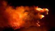
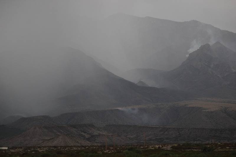
Eric Burk Photo/Gila Valley Central: Lightning caused the Frye Fire, visible as a plume of smoke near lower center of the image. A second thunderstorm on the evening of Wednesday, June 7, is pictured here. It pummeled the mountain a few hours later but did not extinguish the fire.
Thunderstorms across the state resulted in multiple other lightning-caused fires the same day. Most of the fires have been put out but a variety are still burning.
“This is the time of year in early June when we are most vulnerable for (lightning-caused fires,” Meyer said.
Schewel added that it is imperative to be fire-aware at this time of year.
“The Frye Fire is one of the examples of conditions that are out there on the ground,” she said. “There is a lot of fuel available across the forest at different elevations and all it takes is one spark to start a wildfire.”
The fire has also resulted in the closure of several trails, including Ash Ridge Trail #327, Frye Canyon Trail #36, Round the Mountain Trail #302, Deadman Trail #70, Noon Creek Ridge Trail #308, Gibson Canyon Trail #318, Arcadia Trail #328, and Heliograph Trail #328A. No roads or campgrounds in the Pinaleño Mountains are closed at this time.
Stage I Fire Restrictions
Beginning May 24, 2017, and until rescinded, the following are prohibited:
• Building, maintaining, attending, or using a fire, campfire, charcoal, coal, or wood stove fire, except within a developed recreation site, or improved site.
• Smoking, except within an enclosed vehicle or building, a developed recreation site, or while stopped in an area at least three feet in diameter, that is barren or cleared of all flammable materials. (Smoking is prohibited in federal buildings including rest rooms.)
• Discharging a firearm, air rifle, or gas gun, except while engaged in a lawful hunt pursuant to state, federal, or tribal laws and regulations.
• Welding or operating acetylene or other torch with open flame (prohibited on Coronado National Forest).
.