

Emphasis for Sunday is protecting Turkey Flat
By Jon Johnson
MOUNT GRAHAM – The Northern Rockies National Type 1 Incident Management Team is taking over management of the Frye Fire from the Southwest Area Incident Management Team 3, which is a Type 2 Incident Management Team. The new team will transition at 6 p.m., Sunday, and is the highest level of incident management team.
The fire is now listed at 37,068 acres with 39 percent containment. It is the largest active wildfire in Arizona and the second largest in the country, behind the Brian Head Fire in southern Utah, which has exceeded 40,000 acres.
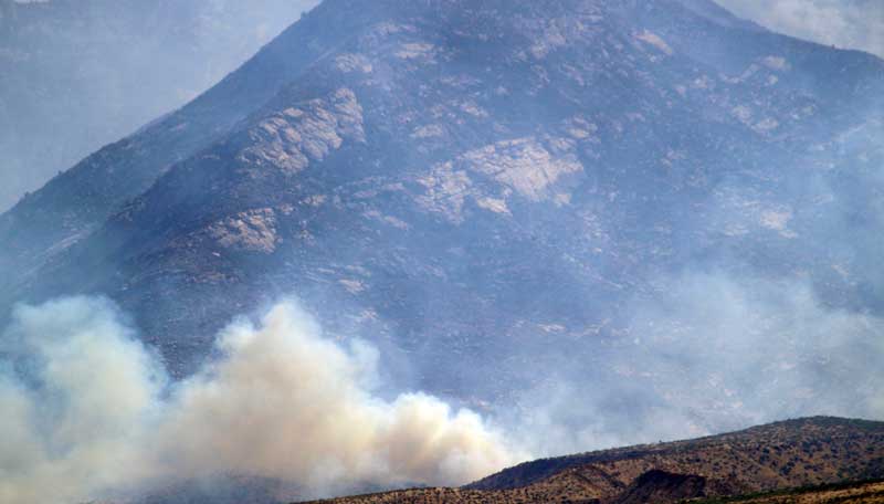
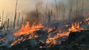
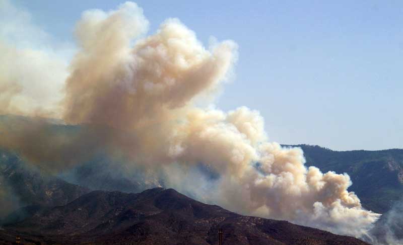
Jon Johnson Photo/Gila Valley Central: Smoke rises from the Frye Fire’s eastern flank.
“The Forest Service is deeply grateful for the Southwest Area Team 3’s progress in meeting the strategy of confining and containing this fire,” said Coronado National Forest Agency Administrator Jim Copeland. “It was crucial to meet the most important objective of firefighter and public safety. Their leadership has created an atmosphere of success for the incoming team.”
There are now 943 personnel working the fire, with 31 engines, 26 crews, 10 helicopters, three dozers and 10 water tenders.
Frye Fire public information officer Cameron Eck said the objectives will stay the same with the new Type 1 Team coming in to manage the fire.
“We’re still all about firefighter safety as the priority and protecting the public and the public’s property,” Eck said.
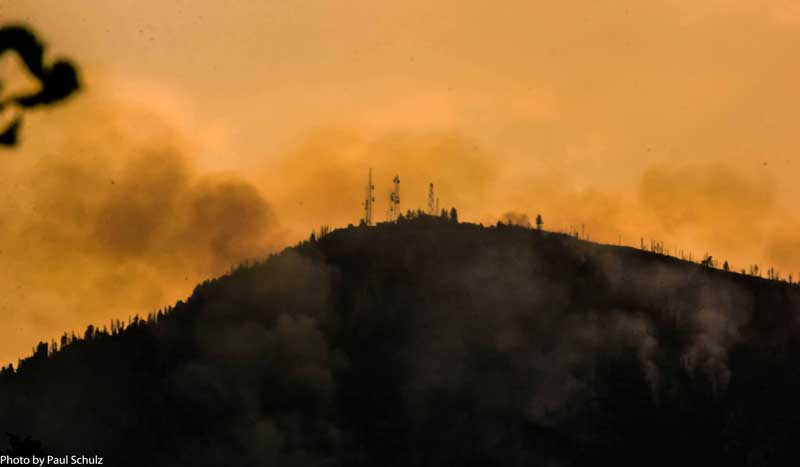
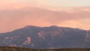
Contributed Photo/Courtesy Paul Schulz: This picture of Heliograph Peak shows the fire’s progression early Saturday evening.
On Saturday, firefighters concentrated their efforts on protecting the Turkey Flat area, where 74 cabins are located in the lower and upper areas. The fire’s progression had hit Noon Creek on Saturday, and firefighters continue to battle it the best they can.
“They still have all the structure protection plus all the resources that are in there,” Eck said. “We’re still engaged with the whole fire but definitely today the emphasis is on the Turkey Flat area.”
The area has been prepped with roughly five miles of hose line and approximately 40,000 gallons of water, which includes self-managing pump stations with 1,800-gallon tanks with 5-gallon fuel systems to run without anyone maintaining them if firefighters are not able to be inserted due to dangerous conditions. The area has been wetted down by the sprinkler systems for several days.
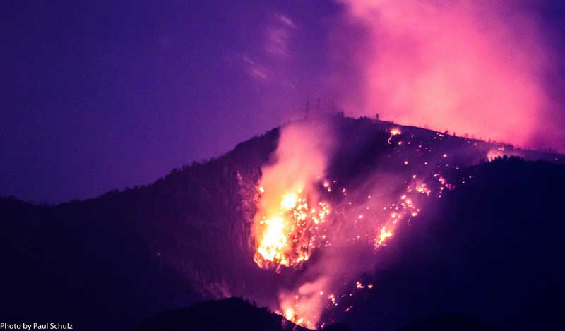
Contributed Photo/Courtesy Paul Schulz: The same area of Heliograph Peak is shown here with fire spreading later Saturday evening.
Additionally, firefighters performed an aerial back burn in the Heliograph Lookout Tower. A historic cabin at the lookout was also covered in heat-resistant wrap.
Heavy winds last night swept through and caused spotting below Highway 366 near Heliograph, according to Eck. While the fire was active in the area, Eck said there was no damage to the towers.
Western Flank
Jon Johnson Photo/Gila Valley Central: The Frye Fire’s western front remains active as firefighters wait for it to come down to where they can effectively fight it.
The western flank of the fire remains in a monitor status. The fire in and around Shingle Mill progressed into Nuttall Canyon, according to a news release. With firefighter safety paramount and little in the way of assets in the area, the decision is to let the fire burn down to a more defensible area where firefighters have a more likelihood of success putting it out, according to Southwest Area Incident Team 3 Operations Sections Chief Ralph Lucas.
Bar X Fire
The Bar X Fire was started by lightning June 21 about five miles south of Ladybug Peak. It has burned 2,784 acres of mostly grassland and has 100 firefighters staffed.
Some rain hit the area Saturday and dampened the grass, limiting the fire’s spread. As of Sunday, it was listed at 93 percent containment.
Closures
The Area Closure for the Frye Fire includes all campgrounds, roadways and trail systems within the Forest boundary in the Pinaleño mountain range with the exception of State Highway 266 from its intersection at the eastern Forest boundary to its intersection with the western Forest boundary. Graham County Sheriff’s officers will stop any non-essential-fire traffic to maintain safety in the closure area. The closure will remain in effect until rescinded. The full closure order and map is available on Inciweb at: https://inciweb.nwcg.gov/incident/article/5221/35695/.