


Contributed Article

SAFFORD – On Thursday, Sept. 14 the closure on Mt. Graham, located on the Coronado National Forest, Safford Ranger District, will be adjusted to include just the high-severity burned areas resulting from the Frye Fire. A number of recreation sites will open, as well, while others remain closed for public safety purposes. The closure adjustment coincides with the Arizona Department of Transportation reopening State Route 366 (also known as Swift Trail).
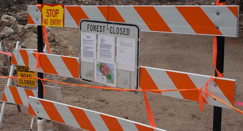
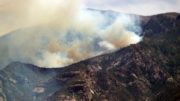
Jon Johnson Photo/Gila Valley Central: While some trails and campsites are reopening, others will remain closed until April 15, 2018.
Two general areas are included within the updated closure. The Grand Hill forest closure area begins at the intersection of Swift Trail and Lower Hospital Flat Road #652 and proceeds south to the intersection of Treasure Park Road #89 and Spur Road #4554, then proceeds southwest to Big Creek, then south to the Wilderness Study Area (WSA) boundary, then follows the WSA boundary northwest to Grant Creek, then follows Grant Creek to Swift Trail, then follows Swift Trail southeast to the closure beginning.
The Webb Peak forest closure area begins at the intersection of Swift Trail and Bible Camp Road #508, then follows Swift Trail west to Chesley Flat Trail #987, then follows Chesley Flat Trail #987 northeast to the Wilderness Study Area (WSA) boundary, then follows the WSA boundary east to Round the Mountain Trailhead, then follows Bible Camp Road #508 back to the beginning of the closure, excluding the Bible Camp and Old Columbine areas.
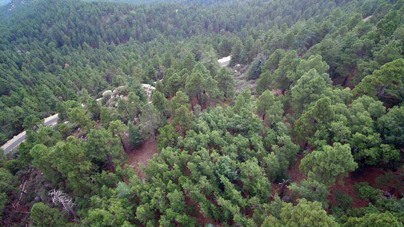
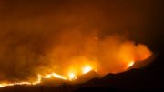
Jon Johnson Photo/Gila Valley Central: The Frye Fire burned 48,443 acres on Mount Graham but mostly in a mosaic fashion with less than 2,000 acres burning at a high-severity. This has left plenty of healthy trees in the forest.
All trails within the closure areas remain closed, including Grant Hill Loop trails #322, #322A, #322B, #322C; Grant Creek Trail; #305; Webb Peak Trail #345; Ash Creek Trail #307; Ash Creek Detour Trail #307A; and Frye Canyon Trail #36.
All campgrounds within the closure areas remain closed, including Lower Hospital Flat, Columbine Corrals, Grant Creek dispersed area, Large Rock dispersed area, as well as Wet Canyon Picnic Area and Noon Creek dispersed recreation area.
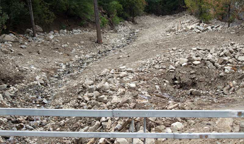
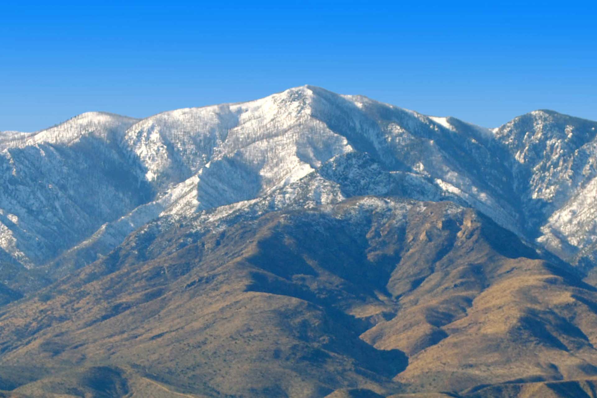
Jon Johnson Photo/Gila Valley Central: The aftermath of the Frye Fire has caused more damage in most areas than the fire itself as flooding has eroded recreation sites and roadways.
All roads within the closure area remain closed including Frye Mesa Road #103 from the intersection with Frye Mesa Reservoir Road #103A to its terminus at Frye Canyon Trailhead, Webb Peak Road #88, Columbine Corrals Road #4577, Lower Hospital Flat Road #652, Treasure Park Spur Road #4554, and Snow Flat Spur Road #4559.
The closure will remain in place for the protection of the public during wildland fire restoration work until April 15, 2018, or until it is rescinded, whichever occurs first.
For more information, please contact the Safford Ranger District at (928) 428-4150 Monday through Friday between 8 a.m. and 4:30 p.m. The office is closed on weekends and federal holidays.