

Turkey Flat cabin owners able to return
By Jon Johnson
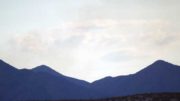
MOUNT GRAHAM – The Frye Fire has burned 48,443 acres on Mount Graham, but with the monsoon moisture dousing the flames the Forest Service has decided to shrink the closure area and reopened Mount Graham on Friday morning up to Ladybug Saddle.
That means those with cabins at Turkey Flat will be able to return to those homes.
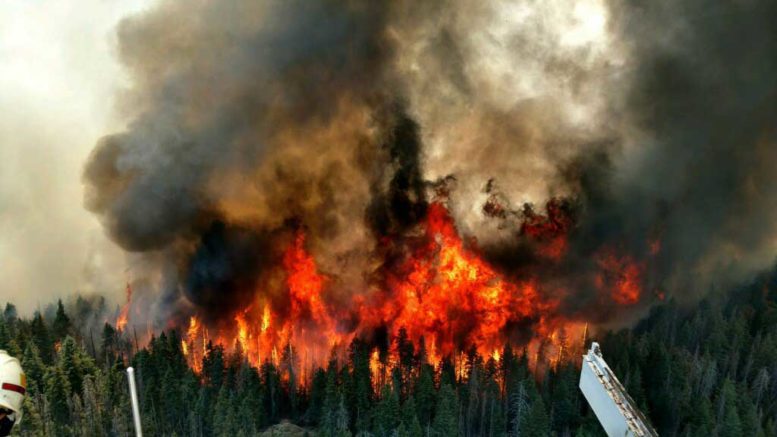
For the first time since lighting started the Frye Fire on June 7 at about 2:45 p.m., there was no reported growth overnight from Wednesday to Thursday. No new growth was recorded Friday either, and containment is now listed at 91 percent. The cost to fight the fire to date is $24.2 million and, as of Friday, there was 50 total personnel still active on the Frye Fire.
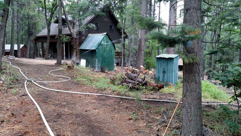
Contributed Photo/Courtesy Forest Service: Cabin owners at Turkey Flat will be able to check on their property, starting Friday.
Highway 366 will still be closed at Ladybug Saddle, which has a high burn severity area above the road that has caused rocks to fall across the roadway on a consistent basis. The Arizona Department of Transportation has been working to keep the roadway clear.
The updated closure will also open West Peak and everything west of Taylor Canyon will be reopened, according to Scott Glaspie, assistant fire management officer for the Safford District. However, Old Columbine remains closed, according to the Forest Service. Additionally, Cluff Ponds #3 will reopen Saturday, according to the Arizona Game & Fish Department. The pond had been closed for aerial operations as helicopters siphoned water out of it to be used on the Frye Fire. Angle Orchard has also announced it will be open Saturday for peach picking. For more information about the orchard call or text (928) 322-2769.
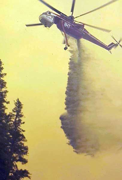
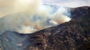
Contributed Photo/Courtesy Fort Grant Hand Crew: A Sky Crane helicopter drops a load of water on the Frye Fire. Roughly 1 million pounds of water was dropped by aviation operations.
Southwest Area Type 2 Incident Command Team Incident Commander Jeff Andrews said for people who need to go further up Highway 366, an exemption on a case-by-case basis will be available.
“We want to say ‘yes’ more than ‘no,’” Andrews said. “There (have) been some flows across the road; there’s still some hazard trees that are out in many of the areas across the top of the mountain and so we’re going to assess each area there before we go ahead and decide we’re going to allow folks to go in there.”
The Frye Fire started by lightning at about 2:45 p.m. on June 7 and has burned for more than a month. Aerial suppression was a major factor in the suppression efforts with 2 million gallons of water delivered via aviation operations and 416,000 gallons of retardant.
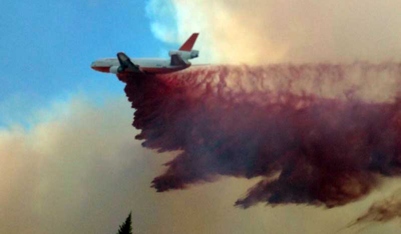
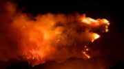
Contributed Photo/ Courtesy LBTO (K. Newton): An air tanker makes a fire retardant slurry drop next to the MGIO to help stop the fire and save the observatory June 18. Roughly 416,000 pounds of retardant was used on the mountain.
“That’s no small task,” Andrews said. “There’s a lot of risks that people have shouldered to get that water delivered up on the mountain.”
Starting Thursday night at 7 p.m., the Frye Fire was transferred to a Coronado National Forest Type 3 management organization, which is the fifth incident management team to oversee the fire. Basically, the team will have a limited number of personnel and resources to finish mopping up and help with restoration efforts.
Flood concerns
A Burned Area Emergency Response (BAER) Team has analyzed the mountain and Salek Shafiqullah, Coronado National Forest hydrologist and lead BAER team member on the Frye Fire said the fire has burned in a mosaic pattern with a variety of low-, middle-, and high-intensity burn areas.
“The fire doesn’t burn in a perfectly consistent way across the landscape,” Shafiqullah said.
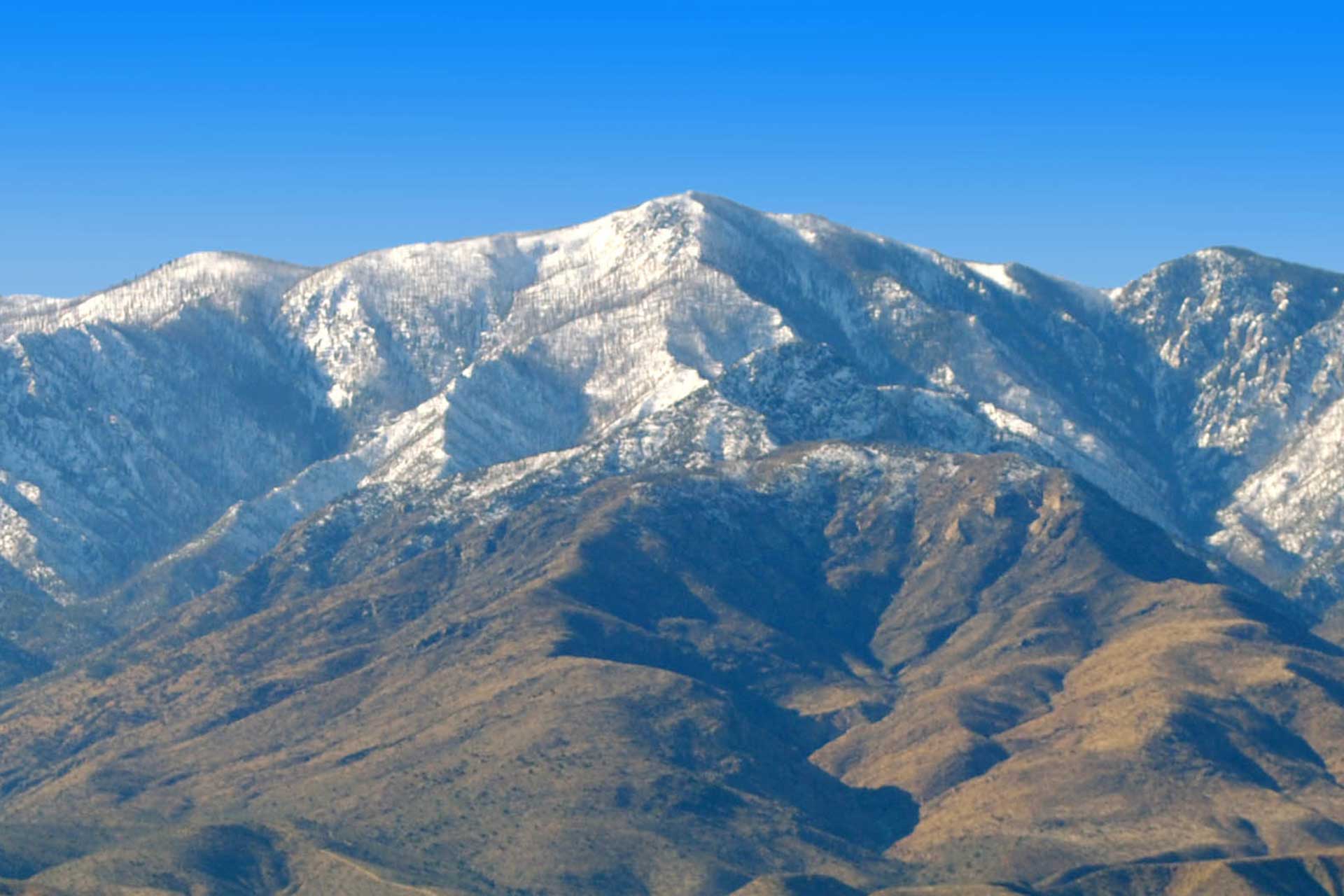
He said one of the areas that had a large swath of high-severity burning was in the Webb Peak area and that high-severity burned area are more likely to have flood potential.
“So, when the mountain is open and we go to Webb Peak it will be black sticks all the way around it,” Shafiqullah said.
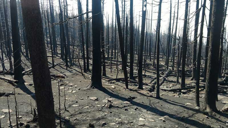
Contributed Photo/Courtesy LBTO J. Riedl: Ash coats the ground covering areas burned by the Frye Fire. Forest Service representatives are advising the public to be wary of flood concerns due to the fire this monsoon season.
However, the variety of burn severity will help dilute the flood potential, according to Shafiqullah.
“There are areas where a lot of the trees are still there and other areas where all the trees are burned all the way to ash,” Shafiqullah said.
He added that firefighting efforts “really did” pay off on the top of the mountain, where there is more of a mosaic burn pattern, but the burned areas have a lot of ash that will send black water coming down every corner of the mountain because the fire burned every corner to the top. One of the dangers of ash water is that it is more viscous and can more easily carry debris.
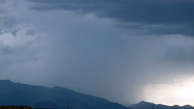
Jon Johnson Photo/Gila Valley Central: Monsoon storms, such as this one Wednesday, have helped douse the Frye Fire.
“There (are) a lot of acres on the mountain that did burn – a lot of the mountain that has a tremendous amount of ash on it,” Shafiqullah said. “That ash is going to wash off the mountain at some point. Whether or not it’s this week, within the next month or within the next few months, when that ash comes off the mountain it will be black, it will be mixed with the water. The water will basically be washing the mountain off, so there will definitely be a lot of black water coming down every corner of the mountain because the fire burned all the way around the top.”
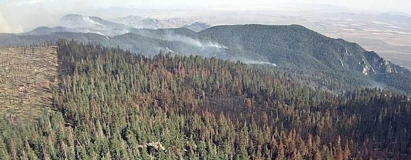
Contributed Photo/Courtesy LBTO J. Riedl: The Frye Fire has burned in a mosaic pattern, leaving strands of trees unaffected.
He said the Frye watershed burned in the Nuttall Complex Fire of 2004 but the Ash Creek watershed did not, but this time both watersheds burned, adding an extra element that the Gila Valley will see on the north side. Additionally, the Nuttall Complex Fire never really went over the ridge, but the Frye Fire did and will produce black water in Grant Creek and the backside drainages.
Wildlife and reseeding
According to Frye Fire representatives, most of the wildlife on the mountain are fine and deer and turkey have already been witnessed returning to the burned areas.
With Mount Graham being a sky island, the Coronado National Forest has a seed collection and it will reseed with only native species.