


MGIO, Bible Camp, Old Columbine no longer threatened
By Jon Johnson

MOUNT GRAHAM – The Southwest Area Incident Management Team 3 has set 250 firefighters, including Hot Shot crews, in place to battle the Frye Fire as it heads toward the cabins at Turkey Flat.
The Frye Fire is now listed at 35,569 acres with 29-percent containment while it continues its southeastern growth and western growth while its northern progression was stifled at the base of the mountain after running low on fuel sources and the efforts of numerous firefighters, who helped keep the fire from heading closer to residences at the base of Mount Graham. While it previously earned the dubious distinction of being Arizona’s largest current wildfire, it now has also surpassed the Nuttall Complex Fire of 2004, which burned roughly 30,000 acres. The fire had been consuming downed logs and dead trees left over from the Nuttall Fire, but has moved beyond its parameters.
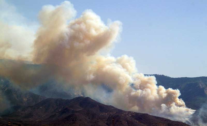
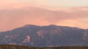
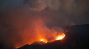
Jon Johnson Photo/Gila Valley Central: The Frye Fire’s western front remains active as firefighters wait for it to come down to where they can effectively fight it.
The main thrust of the firefighting action is protecting Turkey Flat, which has 74 cabins. The area has been prepped with roughly five miles of hose line and approximately 40,000 gallons of water, which includes self-managing pump stations with 1,800-gallon tanks with 5-gallon fuel systems to run without anyone maintaining them if firefighters are not able to be inserted due to dangerous conditions. The area has been wetted down by the sprinkler systems for several days. A back burn has also been performed near Heliograph Lookout Tower. The back burn was started via helicopter, which dropped a Delayed Aerial Ignition Device (DAID) or ping pong ball system. The DAID utilizes plastic spheres containing potassium permanganate and are injected with ethylene glycol before being immediately jettisoned. The chemicals react thermally to produce a flame that consumes the ball. The balls can be efficiently dropped to create most any type of burn pattern desired. A helicopter followed up the aerial ignition with water drops to lessen the intensity of the fire.
“Turkey Flat is fully prepped, it is fully sprinklered,” said Southwest Area Incident Team 3 Operations Sections Chief Ralph Lucas in an operational briefing.
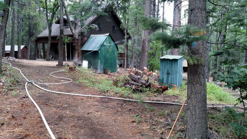
Contributed Photo/Courtesy Forest Service: This picture shows the sprinkler system put in place at Turkey Flat.
The fire’s western front is still progressing in its westerly flow as firefighters are waiting for it to come down to a lower elevation where they can engage it in a more successful manner.
Along the northeastern front facing Safford, Thatcher and Pima, firefighters have a solid fire break and the fire in that area is mostly extinguished and poses no more problems.
Structures on top of Mount Graham
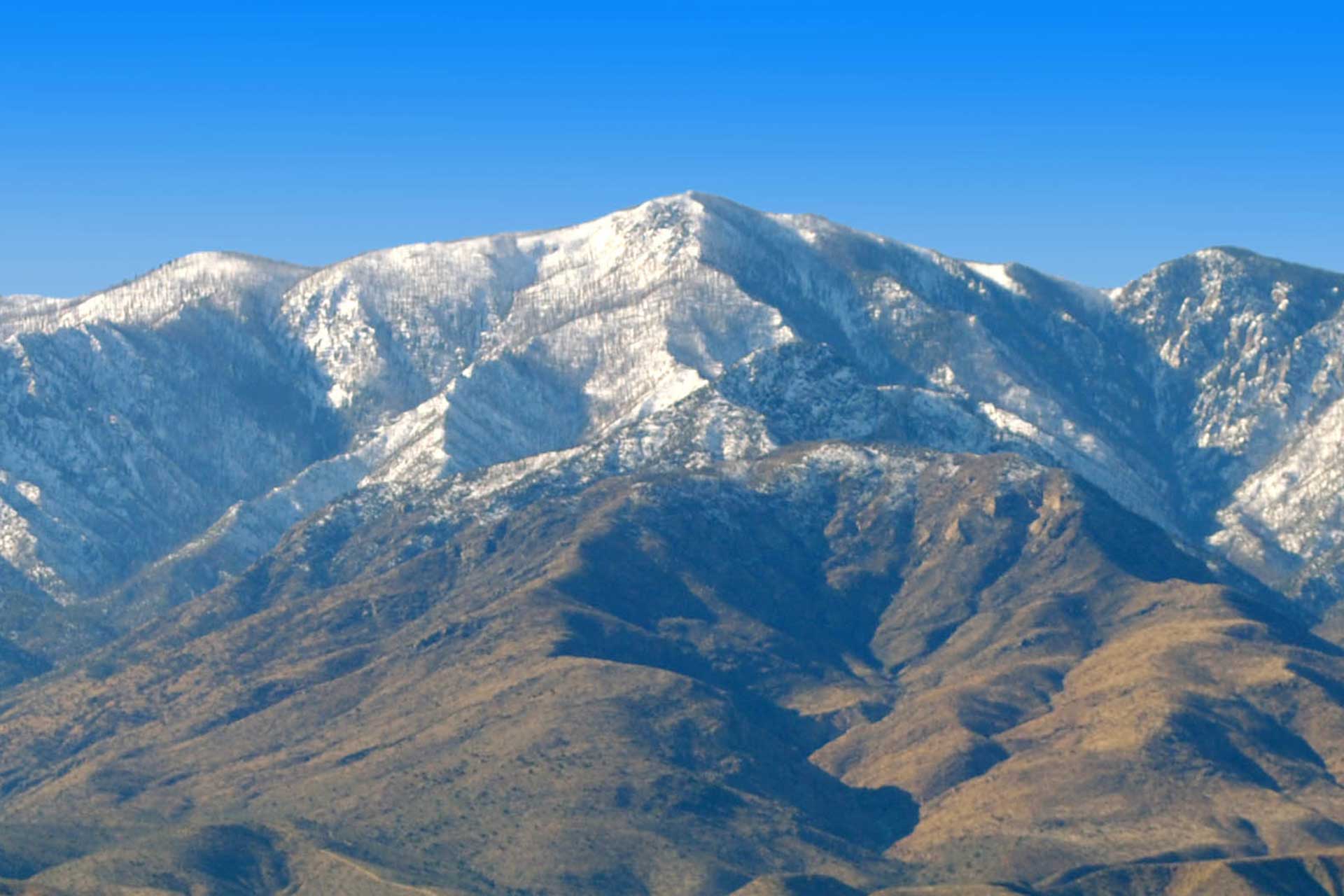
All of the structures near the top of Mount Graham on its northern face, including the Mount Graham International Observatory, Bible Camp, Columbine and cabins at Old Columbine, are now listed as being safe from the fire, according to Lucas. The team released aerial images of the area showing the assets in tact and said they would allow representatives in one- to two-person units to tour the area in the coming days to view the sites and report back to cabin owners and others.
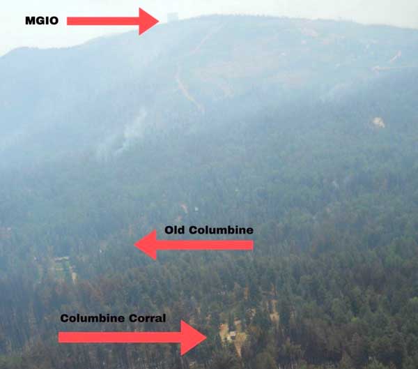
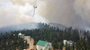
Contributed Photo/Courtesy Forest Service: This photo released by the Forest Service shows the assets on the northern face of Mount Graham as they appeared Friday, June 23.
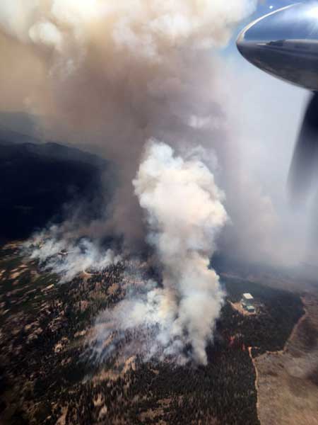
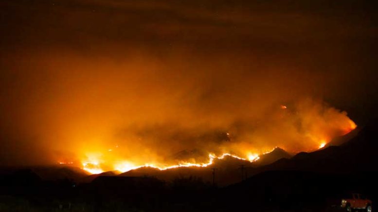
Contributed Photo/Courtesy Forest Service: This was the view from a firefighting airplane when the observatory was threatened.
“We’ve removed that from the values-at-risk status,” Lucas said in an operational briefing. “It is now just in a monitoring status, which means that we have a high confidence that all of the structures, the telescope and the infrastructure up there is sound and good.”
While the MGIO has been removed from the at-risk status, it had fire approach within 50 feet of the site June 18 and the Vatican Advanced Technology Telescope is believed to possibly have suffered some heat damage. An assessment is still pending.
The Frye Fire was started by lightning June 7 at 2:45 p.m.
Bar X Fire
The Bar X Fire was started by lightning June 21 and has burned 2,769 acres of mostly grass south of Highway 266. Lucas said a solid fire line has been placed around most of that fire and that it is not believed to be troublesome. The fire has a listed containment of 52 percent.