


By Jon Johnson

SAFFORD – The Frye Fire on Mount Graham is in the burn scar of the Nuttall Complex Fire of 2004. With the memory of that devastating blaze in the minds of those who were around for it, the U.S. Forest Service is inviting the public to hear firsthand about their efforts and how they are dealing with the current fire.
The public is invited to a community meeting tonight, Monday, June 12, at 7 p.m. in the Graham County General Services Building at 921 W. Thatcher Blvd.
As of Monday morning, the Frye Fire was listed at 350 acres as it continues to grow along both its western and eastern edges with 0 percent containment. The fire began Wednesday, June 7, at about 2:45 p.m. when lightning struck the mountain. A second, smaller fire began with another lighting strike but was extinguished by the same thunderstorm.

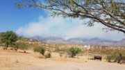
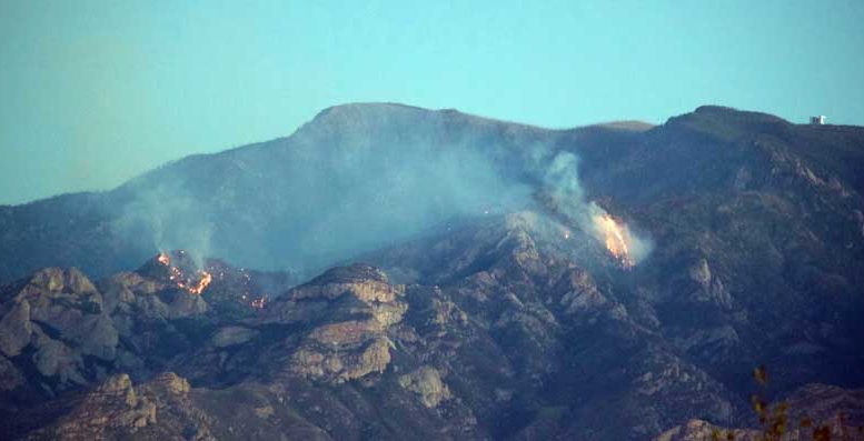
Eric Burk Photo/Gila Valley Central: Lightning caused the Frye Fire, visible as a plume of smoke near lower center of the image. A second thunderstorm on the evening of Wednesday, June 7, is pictured here. It pummeled the mountain a few hours later but did not extinguish the fire.
The Gila/Las Cruces Type 3 Incident Management Team is under command of the fire suppression effort, and the strategy remains to fight the fire indirectly due to various personnel hazards and the beneficial aspect of where it is currently burning. The area has a lot of snags (standing dead trees) that pose a significant risk to ground personnel, according to Gila/Las Cruces Type 3 Incident Management Team Public Information Officer Nick Smokovich.
“There have been some previous fires since the Nuttall where they have gone in and directly tried to suppress the fire and had near fatalities where snags fell very close (to the) crews,” Smokovich said. “So, that was one major emphasis as to why they chose to do this confine and maintain strategy – to not expose crews to the hazards of snags falling.”
Teams continue to repair old fire lines from the Nuttall Complex Fire to the north and tying into Pinnacle Peak.
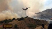
“The perimeter of it is under monitor status,” Smokovich said. “We’re flying it daily to be sure that we have an accurate size and which areas it’s in. As it moves into areas where there is a slope and can cause any runs, they’ll burn from that to kind of mitigate the intensity of the fire.”
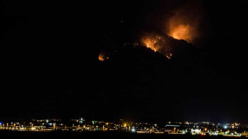
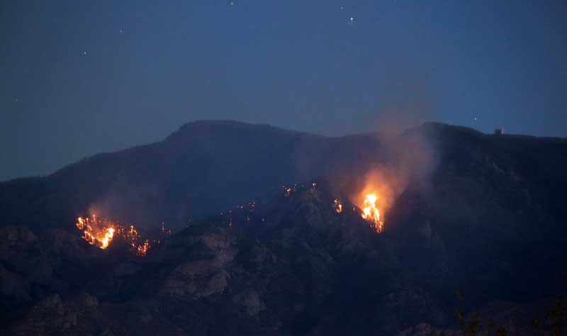
Contributed Photo/Courtesy Paul Schulz: The Frye Fire glows in the darkness as seen from across the Gila River on Sunday night.
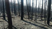
The strategy is to keep it in the previous fire’s burn scar. The Nuttall Complex Fire burned roughly 30,000 acres and has a lot of downed logs and partially burned features that is now being consumed, in part, by the Frye Fire. The area is also very rough terrain, and is being partially managed through the air by water drops from helicopters as inserting people at the site is not safe.
“It’s basically not making any significant growth,” Smokovich said. “It’s just a consistent, steady grow, burning around the perimeter as it consumes those logs and downed material and also some snags that are there.”
A total of 152 people are currently assigned to fight the fire, with four engines, five crews, a helicopter, dozer, excavator and miscellaneous other resources.
The fire continues to burn timber, downed logs, grass, brush and understory while basically having wind-driven runs while it flanks itself and creeps along.
“The fire is doing some beneficial, hazardous fuel removal by consuming all that heavy material that will continue to keep falling to the ground as those dead trees fall over,” Smokovich said. “By removing that, as vegetation starts to grow in to those burn scars, it won’t burn as intense if some of that material is gone. It is helpful in the sense that it’s removing accumulations of fuel, but the main strategy is to confine this fire to just a limited area.”
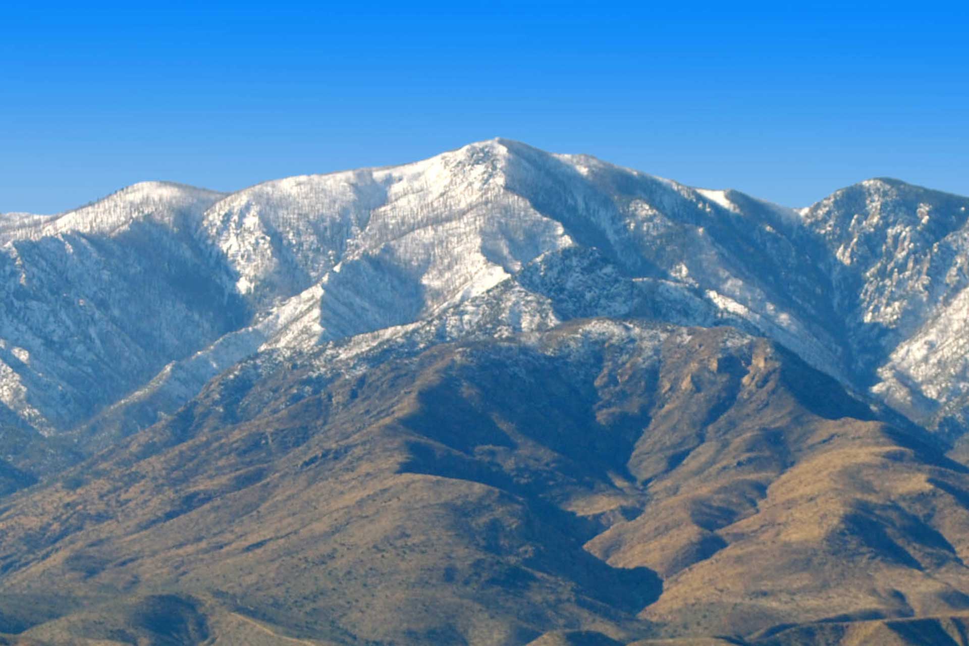
Jon Johnson Photo/Gila Valley Central: The Frye Fire’s eastern and western edges can be seen in this picture. The MGIO is shown in the upper right portion of the photo.
According to projections, the fire is expected to grow to its north and east but pictures by Gila Valley Central have shown it to also grow western, toward the Mount Graham International Observatory. The MGIO was threatened by the Nuttall Complex Fire in 2004, but has significant fire breaks and is not threatened by the Frye Fire. Smokovich said part of the indirect suppression efforts have been to prepare along the road to the observatory, removing snags and making it safe.
“When and if the fire ever reaches that location, (firefighters) can safely burn off those control features and contain the fire within that perimeter,” Smokovich said. “No burning will occur until the fire dictates that it is approaching those areas.”
Weather conditions of higher temperatures and lower humidity could increase the growth of the fire.
The estimated containment date is still listed as July 30.
CLOSURES: Restricting the public from entering the following area of the Pinaleño Mountain Range – East forest boundary on 366 to Noon Creek to a point north and east of Shannon Camp Ground continuing northwest to FR507 then to FR669. Continue northwest and exclude Mt. Graham International Observatory, Old Columbine and Bible Camp. Continue southwest to FR 803 at Soldier Creek Camp Ground then west-northwest to FR 88 to Webb Peak- Straight north to Forest Boundary- Proceed east, then southeast along Forest Boundary.
The following trails are closed: Ash Ridge Trail # 327, Ash Creek Trail #307, Ash Creek Detour Trail #307A, Frye Canyon Trail #36, Fry Canyon Detour Trail #36A, Round the Mountain Trail #302, Deadman Trail #70, Gibson Canyon Trail #308, Webb Peak Trail #345, Shingle Mill Trail #35, Rincon Spring Trail #331, and Trail #4527 off FR 508. No roads or campgrounds in the Pinaleño Mountains are closed at this time.
Temporary flight restrictions are in effect over the fire area, and remains in place until further notice. This restriction includes “drones” or unmanned aerial vehicles. The public is reminded that “If you fly, we can’t!”
Fire Restrictions: Stage 1 restrictions are in effect on the Coronado National Forest.